
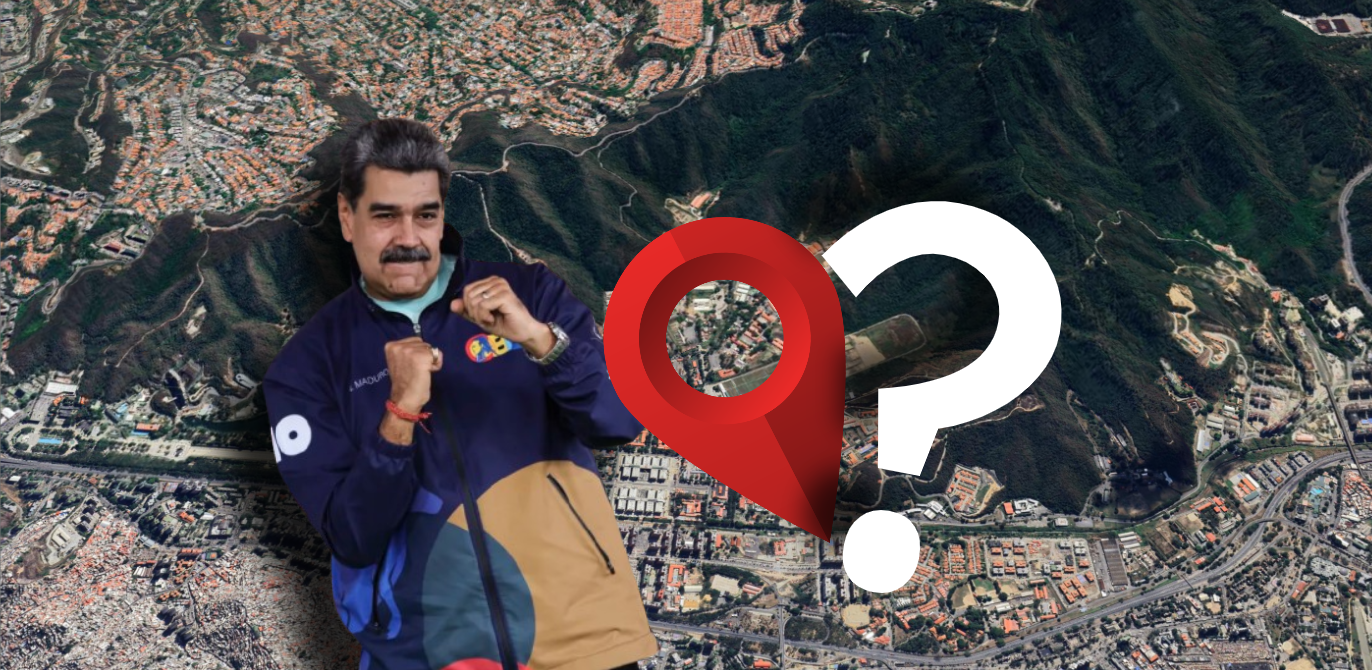
On January 3, 2026, at 02:00 AM, the fate of Venezuela was irrevocably altered. This dossier marks the culmination of an extensive research cycle into Operation Absolute Resolve. It stands as a direct sequel to the previous investigation into the location of Maduro’s capture, providing a chronological and technical breakdown of this historic night. The following are the results of my research.
To navigate the density of this data, this article has been designed with a modular structure. You may explore the operation in its entirety or jump directly to key phases via the links below:
- Infiltration: Analysis of the stealth approach toward Caracas.
- Aerial Offensive: Targeted sites and the initiation of hostilities (~01:57 a.m.).
- Heliborne Assault: Flight trajectories and extraction timeline (~01:57 to 04:29 a.m.).
- Dynamic Mapping: Interactive visualization of the events of January 3.
– Disclaimer and Methodology –
This reconstruction is based on a rigorous analysis of Open Source Intelligence (OSINT). Numerous “grey areas” still persist; this work does not claim to hold the absolute truth, but rather compiles all data verifiable to date, pending further and more exhaustive investigations. To ensure the reliability of this dossier, the following principles have been applied:
- Corroborated Sources: Data is supported by satellite imagery, direct testimonies, and the work of the GeoConfirmed community (videos geolocated as of January 3, 2026).
- Chronological Precision: While official orders are timestamped with certainty, some tactical movements remain estimates based on available visual cues.
- Factual Rigor: This analysis focuses exclusively on the tangible. In the absence of additional video evidence for certain segments, I prioritize the most probable hypothesis over speculation.
This report constitutes an up-to-date documentary baseline but is not intended to replace the findings of future official inquiries.
1. Heliborne Infiltration: Under-the-Radar Approach
One of the central questions of this operation remains: how was an extraction force able to penetrate more than 100 km into Venezuelan territory to reach the capital without being detected? While the technicalities of radar evasion are a field beyond my primary scope, I have synthesized several specialized analyses to provide a clear and concise explanation through the cross-referencing of official statements and available OSINT data. For a more in-depth technical perspective on the radar systems involved, you can refer to this article.
– 23:46: Operation Launch –
According to Caine’s statements during the official debriefing, the presidential order “Move forward with this mission” was issued at 23:46 local Caracas time. It was at this precise moment that the active phase began, with helicopters departing from the naval fleet.
– Fleet Positioning and Approach Vector –
Analysis of Copernicus satellite imagery from January 3 allows for the localization of the majority of the U.S. fleet following the raid:

By deduction, it is almost certain that during the night of the operation these vessels were positioned closer to the coastline, most likely off the shores of Higuerote. This geographic positioning was strategic for the selected infiltration route.
– Flight Profile: 100 feet above the water –
The details provided by Caine shed light on the tactics employed to bypass Venezuelan surveillance:
As the night began, the helicopters took off […] and began their flight into Venezuela at 100 feet above the water.
Flying at an altitude of 30 meters above the water allows for the evasion of long-range radar detection. However, this physical approach was coupled with massive electronic warfare coverage. According to Caine, U.S. agencies (SPACECOM, CYBERCOM) “created a pathway.” Aerial assets preceded the helicopters to “dismantle and disable” air defense systems along the flight corridor.
– A Potential Radar Gap: Higuerote-Caracas –
The choice of Higuerote area as an entry point appears to be far from coincidental. A map of the theoretical Venezuelan radar coverage provided by @gris_area highlights a critical vulnerability at an altitude of 1,500 feet.

A distinct weak point in the radar coverage is visible around Higuerote, opening onto a natural mountainous corridor that passes south of Guatire and leads directly to Caracas. The data suggests that the helicopters exploited this terrain (“hiding in the clutter”), traveling approximately 100 km inland while remaining invisible to radar.
– 01:55: Synchronization and the Element of Surprise –
The arrival at the objective appears to have achieved complete tactical surprise, a claim bolstered by Caine’s official debrief:
As the force crossed the last point of high terrain […] we assessed that we had maintained totally the element of surprise.
This assessment is supported by the visual timeline. Cross-referencing footage of the initial strikes reveals near-perfect synchronization. At approximately 01:55, simultaneous explosions were reported across Caracas, Higuerote, and La Guaira (though some reports suggest the kinetic phase began slightly earlier in Higuerote).
This timing aligns perfectly with the moment the extraction force cleared the final ridgelines south of Caracas. These airstrikes served a dual strategic purpose: the suppression of active air defenses (SEAD) and acoustic masking, using the roar of the bombardments to drown out the signature of the approaching rotors as they closed in on the target zone.
2. Aerial Screen: Neutralization and Suppression of Defenses
The assault on Caracas was far from a series of isolated strikes; it was a highly sophisticated, coordinated suppression maneuver. As the extraction helicopters penetrated the Fuerte Tiuna valley, the Joint Air Component launched a saturation campaign designed to paralyze any unified response.
Around 01:55, simultaneous impacts were recorded across the Caracas, La Guaira, Higuerote and Miranda districts. While some sources reported explosions as early as 01:50 in the Higuerote sector, these claims currently lack tangible visual corroboration.

The objective of this initial barrage was two-fold:
- Diversionary Tactics: By engaging peripheral targets, the air component forced the FANB (Bolivarian National Armed Forces) command to fracture its resources and focus, successfully masking the true objective of the incursion in the heart of the capital.
- A Protective Shield: By targeting radar infrastructure and anti-aircraft systems the moment the helicopters reached Caracas, U.S. forces “opened” a sanitized corridor for the extraction. This strategy was designed to render Venezuelan forces incapable of mounting a counter-attack or pursuing the fleet once the element of surprise had vanished.
Some acoustic analysis of specific strikes reveals a distinct sound signature, confirming the synchronized deployment of LUCAS-type drones—a first for U.S. operational history. This saturation of the airspace with autonomous, low-observable platforms suggests a strategic intent to deliver high-precision, simultaneous strikes. This method effectively overwhelmed enemy defenses while maintaining a significantly smaller radar footprint compared to conventional aircraft.

This spectrogram provides a spectral analysis of a video captured near La Carlota Airport, isolating the unique acoustic signature of a LUCAS-type drone. From 0.0s to 2.4s, the horizontal harmonics represent the steady RPM of the drone’s motor as it approaches the target. The abrupt vertical “wall” of broadband noise at the 2.5s mark represents the exact moment of detonation upon impact, effectively terminating the acoustic signal. This data confirms the operational deployment of these loitering munitions in the Venezuelan theater. You can find many other videos featuring this exact same signature.
This chapter details the tactical assessment of the targeted sites—operations that were critical to ensuring the return flight to the fleet could be conducted without surface-to-air threats or aerial interception. Based on current data, no other significant strikes have been confirmed outside of these perimeters.
– Neutralization of the 393rd Anti-Aircraft Missile Defense Group –
One of the high-priority targets of this initial offensive was the 393rd Anti-Aircraft Missile Defense Group (GMDA) in Catia La Mar, a cornerstone of the Venezuelan defensive grid located in La Guaira. Post-strike Battle Damage Assessments (BDA), compiled from two distinct sources, reveal the extensive damage inflicted upon this unit.

Sources: (1), (2), (3), (4), (5), (6), (7), (8)
Post-strike footage confirms the destruction or severe incapacitation of at least six Buk-M2E surface-to-air missile systems (6) (8). Five of these units were identified within a hangar, while a sixth was positioned externally. This indicates a surgical strike designed to systematically eradicate any anti-aircraft response capabilities within this strategic coastal zone.
However, the engagement resulted in collateral damage, impacting a nearby civilian structure and leading to at least one confirmed fatality (7). Bellingcat has published an exhaustive investigative report on this specific incident, which I highly recommend for further details on the forensic analysis of the strike.
– Neutralization of at least one anti-aircraft vehicle in the port of La Guaira (one confirmed) –
A secondary strike targeted the Port of La Guaira, resulting in the neutralization of at least one anti-aircraft vehicle positioned on the docks (6). An X thread by @trujillocorreo reports the destruction of two Buk-M2E systems at this location.

Sources: (1), (2), (3), (4), (5), (6)
– Neutralization of two anti-aircraft vehicle in the Special Forces Specialisation Complex in the state of La Guaira –
The Special Forces Specialization Complex in the state of La Guaira was also targeted, resulting in the neutralization of two additional anti-aircraft vehicles (2).

Sources: (1), (2): 🔗 &🔗
– Probable neutralization of two anti-aircraft vehicles at Higuerote airport (one confirmed) –
Higuerote Airport was also the site of targeted strikes.

Sources: (1), (2), (3), (4), (5), (6), (7)
While ground-level imagery from the following day confirms the certain destruction of a first anti-aircraft vehicle (7), the destruction of a second remains “probable.” However, analysis of footage captured during the assault supports this hypothesis (1) (4): the nature and intensity of the secondary explosions observed at the second target strongly suggest the presence of another active anti-aircraft unit on-site. This strike at Higuerote was critical in securing the exit point of the flight corridor used by the helicopters for Maduro’s extraction toward the USS Iwo Jima.
– Neutralization of the 392nd & the 398th Anti-Aircraft Missile Defense Group in Fuerte Guaicaipuro –
The Fuerte Guaicaipuro military complex was also targeted by precision strikes. Due to the lack of ground-level video evidence to immediately assess the extent of the damage, the analysis relies on satellite imagery captured following the operation (2).

Sources: (1), (2)
These records reveal major structural damage, heavily concentrated within the perimeter occupied by the 398th Man-Portable Air Defense Missile Group (GMDAP). While the 392nd Anti-Aircraft Missile Defense Group (GMDA) was also targeted, the severity of the impacts observed on the 398th’s facilities indicates that this unit bore the brunt of the offensive in this sector.
– Neutralization of radar coverage, telecommunications, electrical substations, and anti-aircraft vehicle around Caracas –
The initial offensive on the outskirts of the capital was designed to strategically blind the local forces.

Sources: (1), (2), (3), (4), (5), (6), (7), (8), (9), (10), (11), (12), (13), (14), (15), (16), (17)
Strikes concentrated on critical communication nodes and radar stations, specifically the Cerro El Volcán site (10), the 3911th “Altos de Irapa” Surveillance and Control Squadron complex (7), as well as relay stations at the Mathematics Center (5) and an antenna in Ciudad Tiuna (13). Notably, a strike incident was recorded below El Volcán: an off-target impact hit residential infrastructure (9), highlighting the inherent risks of collateral damage when engaging targets in dense peri-urban areas.
To ensure air superiority within the valley, intervention units proceeded to eliminate a Buk-M2E positioned at the La Carlota airfield (17). Simultaneously, the militia command post, entrenched in the Caracas Observatory (2), was neutralized to sever the coordination chain of irregular forces.
The final component of this phase aimed for the tactical blackout of the operational zone. The targeting of the “La Gran Caracas” Electrical Substation was the pivotal element of this maneuver (3). By neutralizing this infrastructure, the assault forces triggered a systemic power failure across multiple circuits: Nueva Granada, Caricuao, Prado de María, Escuela Militar, and Coche.
This coordinated action plunged the Tiuna Valley into total darkness, facilitating nocturnal infiltration operations and paralyzing enemy reaction capabilities (see simulation discussed in Part 3).
– Major Assault on Fuerte Tiuna: The Operation’s Nerve Center –
This final section focuses on Fuerte Tiuna, the heart of the capital’s defensive network. This analysis specifically targets the 02:00 AM tactical window, corresponding to the phase immediately preceding the approach of the helicopter assets. The objective was twofold: to sanitize the landing zone (LZ) and to deliver a psychological shock to destabilize the garrison.
Based on a cross-analysis of five distinct visual sources (POVs), a triangulation of the strikes at 02:00 AM has been established.

Sources: (1), (2), (3), (4), (5)
The study of these impact points reveals the primary targets.

Sources: (1), (2), (3), (4)
A clear targeting logic emerges, despite the opacity surrounding certain installations:
- Energy Component: An internal electrical substation was neutralized at the outset, followed by a strike on the backup generators of the 311th Mechanized Infantry Battalion.
- Air Defense: The infrastructures of the 397th Man-Portable Air Defense Missile Group and the 396th Anti-Aircraft Artillery Group were directly targeted to eliminate any threat to the assault helicopters.
- Access Control and Sensitive Infrastructure: A strategic checkpoint securing access to a bunker on the heights of Fuerte Tiuna—where the 6th Security Battalion of the Presidential Honor Guard was stationed—was completely destroyed. A second checkpoint was targeted, though there is no visual confirmation of the damage to date.
- Fortified Installations: An impact was localized on a pillbox or bunker entrance; its exact function remains unknown.
Regarding the final three recorded impacts, the results are more disparate:
- Probable Targeting Error: One projectile hit a training field, offering no immediate tactical value.
- Area Surveillance: A light structure on a dominant ridge was targeted. Its strategic position, overlooking the presumed extraction sector of Nicolas Maduro, suggests it may have housed a lookout team, snipers, or IGLA-S man-portable systems.
- Undetermined Target: The damage from the final impact (marked with a ‘?’ in the GIF) remains unidentified; it could be a secondary electrical installation or a communication relay.
3. Timeline of Heliborne Operations: The Assault Window
The analysis of aerial movements, spanning from 01:57 to 04:29, outlines an operation of surgical precision. Vacillating between phases of intense engagement and periods of total radio silence, this chronology attempts to unveil a maneuver whose complexity reflects months of strategic planning.
However, reconstructing this timeline through an OSINT lens faces structural limitations that must be addressed:
- Source Volatility: The rapid proliferation of social media reposts tends to saturate the information landscape, making the identification of original sources complex.
- Metadata Decay: Video file compression degrades visual quality and strips native timestamps, at times making temporal synchronization uncertain.
- Tactical Opacity: The visual silence during certain phases suggests a total mastery of the environment (low-altitude flight, avoidance of dense urban areas).
Consequently, this chapter offers a reading based on cross-referenced material evidence while identifying the “gray zones” inherent in an operation of this magnitude.
– Phase 1: From the Valley Incursion to the Assault on the Maduro Compound (01:55 – 02:05) –
Between 01:55 and 02:00, the operation transitioned into its kinetic phase. Simultaneous saturation strikes were reported along the coastal axis (Higuerote and La Guaira) and across the Fuerte Guaicaipuro and Fuerte Tiuna military complexes, creating a strategic diversion for the incursion into the capital. By specifically targeting the power grid, the assault force plunged the Tiuna Valley into an operational blackout.
An algorithmic light-map simulation of Caracas under normal conditions, conducted by @Clemveriis, provides a baseline to visualize the scale of this darkness. This systematic neutralization of the valley’s electrical infrastructure served as the final tactical preparation, allowing the helicopter wing to complete its approach from the south under total visual cover. By overlaying the reported blackout zones, we can see how the systematic neutralization of the valley’s electrical infrastructure provided the helicopters with total visual cover for their final approach. This tactical darkness was further amplified by the geography: approaching from the south, the assault force traversed mountainous terrain where ambient light is naturally near-zero, allowing the formation to remain undetected until the very last moment.

To begin, I invite you to view the following video showing the opening minutes of the assault in the Tiuna Valley. This compilation is based on the various video sources that can be explored in detail within the interactive map in Part 4. The timestamps provided are indicative: “Real-time” refers to sequences synchronized with a timestamped source, while “Estimated-time” is based on the analysis of the aircrafts’ progression.
The main assault force penetrated the valley from the south. Cross-analysis of visual documentation identifies a heavy formation consisting of 7 MH-60Ms escorting 2 MH-47s (2 MH-60s, 2 MH-47, then 5 MH-60). This formation skirted the western flank of the valley, utilizing terrain masking to hide its approach..
A specific Point of View (POV) observation shifts our understanding of the tactical deployment (see video at 01:57). One MH-47, operating independently from the primary formation, was identified in a hover at coordinates (10.44381, -66.91553). Situated just over the ridgeline was the Presidential Honor Guard’s 3rd Security Battalion. This unit appears to have been a primary target during this phase, with multiple vehicles successfully engaged.

Sources: Noticias Venezuela & Jose Abreu
Topographical analysis suggests a dual tactical rationale for this positioning:
- Area Denial: This high ground commands the sole access road linking the heart of Fuerte Tiuna to the Maduro compound.
- Perimeter Security: Inserting elite units on this crest could creates a defensive “plug,” effectively interdicting ground reinforcements while the main assault force focused on the high-value objective.

While tactical doctrine suggests an escort was likely present to provide suppressive fire for this Chinook, the current lack of visual evidence in this specific sector precludes a definitive count of airframes committed to this flank.
In the middle of the video (see video at 02:24), the deployment of flares coupled with several audible bursts indicates a moment of tactical friction before the main group approached. An additional source corroborates these exchanges (around 01:43 of this source), roughly 15 seconds before the arrival of the first two MH-60s of the main group. This sequence appears to mark a transition between the arrival of a main assault group (comprising 2 MH-47s and 2 MH-60s) and the group involving the MH-47 previously observed at a distance.
The most important part of this video is here. In one of these synchronized sequences, one or two MH-47s can be observed at close range conducting an insertion within the perimeter of the Maduro compound (see video between 02:39-03:00). Whether they performed a full landing or a low-hover offload, the critical phase remained remarkably brief: the entire maneuver lasted less than two minutes, strictly limiting the exposure of both the aircraft and the ground force.

This rapid execution is further validated by the official operational briefing:
As the helicopter force ingressed towards the objective at low level, we arrived at Maduro’s compound at 1:01 AM Eastern Standard Time or 2:01 AM Caracas local time, and the apprehension force descended into Maduro’s compound and moved with speed, precision, and discipline towards their objective and isolated the area to ensure the safety and security of the ground force while apprehending the indicted persons.
At the end of the video, two MH-47s escorted by two MH-60s are clearly seen banking toward the south of the valley (see video at 04:30).

The five MH-60s at the rear of the first group’s formation are visually absent by the end of the video. However, footage recorded at approximately 02:05 AM could confirm a maneuver: 5 MH-60s followed by 2 MH-47s were spotted near Hoyo de la Puerta, this time pushing East. A second video showing an identical configuration in the same sector suggests a simultaneous POV from a different angle, though the absence of hard metadata prevents absolute confirmation. This group spotted likely represents the “tail” of the initial formation (the 5 remaining MH-60s) merging with the potential MH-47 observed during the initial hill insertion (and potentially a tactical wingman).

During this phase, the helicopters exploited the chaos generated by the initial strikes to insert ground teams. This scenario suggests a state of tactical saturation: Venezuelan forces likely misidentified the opening strikes as a conventional bombardment, realizing—too late—that heavy-lift helicopters were already hovering over their positions to initiate a ground assault. They arrived at 01:57 a.m. in the Tiuna Valley and left at 02:05 a.m., less than 10 minutes later.
– Phase 2: Securing the Target and Holding Maneuvers (02:05 – 02:45) –
While the insertion phase was rapid and surgical, the following 40-minute window was characterized by intermittent ground activity and a near-total visual “blackout” of the aerial assets.
Audio analysis of several videos confirms that localized engagements continued within the Maduro compound perimeter long after the troops were dropped. Distinct detonations and bursts of automatic weapon fire can be heard. From a tactical perspective, this phase corresponds to securing the High-Value Target (HVT) and the extraction perimeter. The operators’ mission was to neutralize any residual resistance and prepare the “package” for extraction — a procedure requiring seamless coordination before the heavy-lift helicopters returned.
The following video, filmed at 02:15 AM, captures the atmosphere in the valley: a mix of heavy silence and distant detonations echoing through the total darkness:
Regarding the helicopter fleet during this interval, open-source data becomes scarce. The last confirmed positions were a group of seven aircraft at Hoyo de la Puerta heading East at 02:05 AM, and another group of four heading south from the Tiuna Valley. It is difficult to determine if these were two distinct groups or overlapping sightings.
Following these reports, no direct imagery documents their exact position for nearly 40 minutes. However, a crucial clue comes from a video filmed at a dog sanctuary in Los Anaucos. The source reported multiple helicopter passes between 02:00 and 04:00. This location is significant: Los Anaucos sits directly in the natural extension of the “southern corridor,” the primary ingress and egress route for the aircraft. It is highly probable that the fleet transited this area between 02:00 and 03:00.
The lack of sightings over densely populated areas during these minutes suggests terrain masking tactics. It is very likely that the air force established a holding pattern south of the capital. The light-map simulation of Caracas presented earlier adds weight to this theory, showing a sparsely populated and rugged region.

By navigating at low altitude along the ridgelines and looping through this low-density sector, the pilots achieved two objectives:
- Radar Signature Reduction: Avoiding any static exposure above densely populated urban areas.
- Immediate Readiness: Remaining only minutes away from the Pick-up Zone (PZ), ready to pivot as soon as the ground team gave the “Jackpot” signal.
In short, this “window of silence” was not a pause in the operation, but a calculated risk-management phase. While the ground team handled attrition and secured the target, the aerial assets maintained a “ghost presence” to the south, using the Venezuelan topography to stay clear of any active anti-air systems. This strategic wait would end abruptly with the signal for final extraction.
– Phase 3: The Extraction of Maduro (02:45 – 04:29) –
While the infiltration was a matter of surgical silence, the extraction proved to be the most violent kinetic phase of the operation. By 02:45 AM, the element of surprise had completely vanished. US forces shifted from a stealth posture to one of fire saturation to guarantee the exfiltration of the “package.” The action within the compound lasted approximately five minutes (total time on objective).
The following video synchronizes several sources to document the key minutes of Maduro’s extraction. All of these sources are indexed in the interactive map featured in Part 4. Timestamps are provided as estimates based on uploader information and video metadata.
From the start of the sequence, it is evident that the approach vector differs from the initial assault phase: two MH-47 Chinooks emerge from the South via Troncal 1 at 02:45 AM, hugging the eastern flank of the valley. Simultaneously, as they approach the Maduro compound, two MH-60s descend from the Fuerte Tiuna heights to provide high cover.
An air-to-ground engagement by one of the MH-60s is observed upon arrival on-site (see at ~01:35). As the first Chinook begins its landing flare, an IGLA-S missile launch is detected (see at ~01:45). The second Chinook immediately deploys a massive sequence of thermal decoys (flares); the missile passes well above the aircraft before impacting the hillside in the distance.

It is worth noting that luck was a determining factor in the success of this mission; had one of these missiles struck an aircraft, the outcome of the operation would have been drastically different. Following these exchanges, the two Chinooks landed within the Maduro compound to extract the target and retrieve the ground teams.
To lock down the area, several MH-60s saturated the corridor between the compound and Fuerte Tiuna with close air support (CAS). At least six rocket runs and heavy fire from M134 Gatling guns were recorded, aimed at suppressing any retaliatory fire. A particularly striking sequence of four consecutive rocket strikes is observed at the 03:00 mark of the video.
By the end of the footage, the two Chinooks are seen departing just seconds apart (see between 04:00 and 04:25) under the protection of the MH-60s. The two MH-47s ultimately spent only two minutes on the ground for the extraction—a speed of execution vital to the unit’s survival.

Shortly after the assault, silence fell over the valley once again. In a first video filmed from Ciudad Tiuna, two Chinooks can be seen heading East. It remains difficult to determine whether the footage was captured at 02:05 AM or 02:55 AM, as the MH-47 exit trajectories were nearly identical during both windows. A second video shows two Chinooks followed by an MH-60 in Hoyo de la Puerta, but the lack of temporal landmarks makes any definitive conclusion just as complex.
However, a comparative analysis with another video from Hoyo de la Puerta taken at 02:05 AM provides a key clue: the smoke plume observed in the distance do not match. Furthermore, the smoke plume from Cerro El Volcán is not observed in this POV, whereas it is present in the POV from 2:05 AM. This visual discrepancy suggests that the footage is unlikely to date from 02:05 AM. It is therefore probable that it documents the final exfiltration of the two MH-47s leaving the Tiuna Valley at approximately 02:55 AM.

One element remains particularly intriguing: while the extraction at the compound concluded before 03:00 AM, the aircraft were not sighted again until 04:00 AM near Cortada de Maturín—a full hour later. This one-hour gap to cover such a short distance raises a major tactical question: why not leave the territory immediately? This latency suggests an intermediate phase.
In Special Operations doctrine, this delay likely corresponds to the establishment of an Objective Rally Point (ORP) outside of radar coverage. This phase may have occurred for several reasons:
- Fleet Reassembly: Gathering all aerial assets that had been dispersed during the 2 hours assault.
- Battle Damage Assessment (BDA): Conducting a final technical integrity check of the airframes following the engagements during the assault.
- HVI Stabilization: Ensuring the medical status of Maduro and his wife for the duration of the transport.
- Egress Coordination: Waiting for a secure transit window, cleared by air superiority (F-22) and electronic warfare (EA-18G Growler) assets, to safely cross the coastline.
Around 04:00 AM, the armada was finally detected overflying the Cortada de Maturín and Los Anaucos area. Cross-referencing two visual sources allows for the identification of a massive formation: 4 MH-60 + 5 MH-47 + 5 MH-60, moving at high speed toward the East.

The final confirmed visual trace of the armada is located in Capaya, southwest of Higuerote. The evidence for this geolocation is presented below. Although the available satellite imagery is dated and certain terrain features have evolved (changes in vegetation, the roof of the building on the right), but the structural landmarks leave little room for doubt.

This is the only document showing such a large number of helicopters. While the individual filming claims to have counted 15 aircraft, visual analysis identifies 14, maintaining the same formation previously observed at Los Anaucos. Although witnesses on-site indicate a direction “towards Higuerote”, no visual evidence or local reports confirm a direct overflight of this coastal city.
It is therefore more likely that the force followed the mountainous terrain to remain masked by the relief until the last possible moment, emerging over the sea only once the coastline was crossed.

The transit between Los Anaucos and the exit from territorial waters at 04:29 AM (per the official statement) took approximately 29 minutes for a distance of roughly 95 km. This represents an average speed of 190 km/h. While this speed may seem low for an exfiltration phase, it is perfectly explained by the technical demands of tactical flight in mountainous terrain, the coordination of a massive 14-aircraft convoy, and the conditions of total darkness.
Once over open water, the squad began its final sprint toward the USS Iwo Jima to deliver Maduro. As for the rest of his extraction to New York Stewart International Airport, the details are now a matter of public record.
4. Operational Mapping
To centralize all collected evidence, I have developed an interactive map featuring every geolocated document from the night of January 3rd. Each data point includes precise coordinates, a contextual description, as well as direct links to original sources and geolocation proofs.
This entire dataset is also indexed and auditable on the GeoConfirmed platform (entries for January 3rd and 4th). The work carried out by the GeoConfirmed team is vital for the reliability of information in conflict zones. By centralizing and transparently verifying every piece of visual evidence, GeoConfirmed turns raw footage into indisputable facts. Supporting and contributing to such community-driven initiatives is essential in the fight against disinformation and in documenting history with surgical precision.
To help you navigate this map, I have marked all videos featuring helicopter sightings with yellow camera icons. Additionally, you can use the search bar at the bottom to filter for specific assets of interest (e.g., Buk-M2E, MH-47, MH-60, etc.). All raw data is available on the GitHub repository under: VEN-03JAN2026/data/ven_03_jan_2026.js. This interactive map is optimized for desktop use; it offers a much smoother interface and better visibility than on mobile. Click here to view the map in full-screen mode.
Naturally, many other sources exist that are not displayed here; due to time constraints, not every video has been geolocated. However, the most critical evidence has been meticulously documented and indexed in this map.
Conclusion
The January 3rd operation will go down as one of the most audacious aerial raids of the 21st century. Beyond the political stakes, this mission brilliantly exploited the structural flaws of the Venezuelan defense. By striking during the holiday season, US forces capitalized on an understaffed FANB, with much of its personnel on leave. Faced with aging infrastructure and a minimal response from the skeleton crew on duty, the armada’s firepower instantly overwhelmed any attempt at a counter-attack.
This report offers a methodical reconstruction of that historic night. By weaving together video footage, satellite imagery, and witness accounts, the analysis outlines a clear scenario: a nap-of-the-earth helicopter approach combined with an electronic suppression campaign, enabling the penetration of the Higuerote–Fuerte Tiuna corridor and a lightning-fast extraction. However, the success of such a mission often hangs by a thread: a single technical glitch or a more accurate retaliatory strike could have turned this tactical success into total chaos. Audacity never fully eliminates the unforeseen.
Finally, a message to those watching from the shadows: if an event of this magnitude ever unfolds outside your balcony, please, hit record! Even if it’s pitch black, even if it’s blurry. Who knows? You might just help someone try to piece history back together 😉
– Acknowledgments –
I would like to express my deepest gratitude to the OSINT community (@trujillocorreo, @ConflictsW, @Arr3ch0, @gris_area…) whose rigor and pursuit of truth served as invaluable guides throughout this investigation.
Special thanks to the GeoConfirmed team for their certification work, which has become essential to our field.
This report would never have reached this level of precision without the courage of the Venezuelan citizens who reached out via email, or the anonymous sources who shared their observations. Shedding light on these events is truly a result of collective intelligence.
A huge thank you to @cyberfunk33 for his crucial help in sourcing footage and his expertise in video processing and enhancement.
Thanks also to @Clemveriis for providing an image from his stunning simulation of Caracas’ city lights; checking out his work is an absolute must!
Special thanks to @COUPSURE for developing the GeoConfirmed QGIS plugin; it was instrumental in building the interactive map.
Finally, thank you to everyone else I may have missed—your contributions were vital.


Leave a Reply